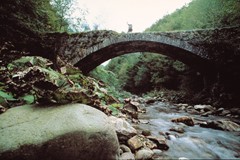
The Via Bibulca.
In the footprints of the ancient wayfarers
We now prepare to tackle a striking excursion along what was one of the most important thoroughfares in the Middle Ages: the Via Bibulca, which for centuries allowed the passage of goods, wayfarers, pilgrims and armies from the wide Secchia Valley to San Pellegrino in Alpe and from there into Tuscany.
With respect to the normal gruelling, tortuous routes that snaked along the side of the Apennines, the Via Bibulca was a cart track at least two metres wide which allowed a cart pulled by two oxen to pass.
Of Roman or Lombard origin, what is certain is that the Bibulca was a road used from the remotest times. It reached its maximum importance in One Thousand AD when across Europe there was a general awakening of religious feeling that led thousands of pilgrims towards Rome, the Holy Land or other major places of worship.
For a long time, the Via Bibulca was part of the property of the powerful Abbey of Frassinoro and every wayfarer had to pay a tax to be able to use this undemanding and relatively safe route.
The Via Bibulca was more than once the subject of a power struggle between the mighty Abbey and the Commune of Modena governed by the Este family of whom the Montecuccoli were faithful feudatories.
The current trail for excursions traces the route of the original Via Bibulca for a distance of 25-30km along mule and cart tracks which form a single grand thoroughfare, in certain sections well marked by the remains of ancient paving or even stretches of asphalt.
Morphologically interesting and varying in its different geological strata and vegetation, the surroundings of this age-old artery change constantly during the climb up to the Apennine ridge. The itinerary begins from the Dolo bridge – just a short way back from where the Dragone and Dolo streams converge – to end up at Montestefano, a place characterised by cultivated areas and gentle slopes. Past the village the route climbs steeply towards the Oratory of Madonna delle Grazie until it reaches Montefiorino perched on a ridge and a natural window that offers a series of stunning panoramas of the surrounding mountains.
A brief deviation takes us to the Parish Church of Santa Maria Assunta at Rubbiano, one of the most significant and harmonious examples of Romanesque art and architecture in the Province of Modena. Very powerful in the Middle Ages, the church probably also functioned as a hospice, providing shelter and refuge for those tackling the Apennine pass.
After Montefiorino, the Bibulca enters its most panoramic stretch, hugging the main summits of the Dolo-Dragone watershed. Other striking views of the highest chains are visible towards the east where the Alpesigola and Sassotignoso ridges emerge, with Mount Cimone in the background in all its glory. Here the surroundings change: the typical hillside vegetation turns into woods of oak and chestnut.
The route continues by winding through the Dragone valley until it reaches Frassinoro, then onwards towards the highest peaks in the Madonna di Pietravolta direction. The surroundings are enriched by new features including beech woods and stratified sandstone formations. The route then arrives at Colle del Morto and traces the Tuscan-Emilian divide to then enter the Frignano Park and stop at the San Pellegrino in Alpe hospice, currently home to the Don Luigi Pellegrini Ethnographic Museum.
